Join us for the National Forum on Rehabilitation-Informed Pandemic Preparedness and Long COVID Research at the University of British Columbia’s Point Grey campus in Vancouver, BC on October 13-14, 2026.
This forum will bring together researchers, clinicians, and people living with Long COVID to share ideas, build connections, and develop plans for future research.
Our goal is to collaboratively develop ideas for future research in two targeted areas: “Safe Approaches to Rehabilitation” and “Access to Safe and Timely Rehabilitation.” We selected these two targeted areas by surveying researchers, clinicians, people living with Long Covid, and caregivers. [1]
Keep in the Loop: Register for the event now or just sign up to stay informed with details!
Where: Room 1312 in the Life Science Centre at 2350 Health Sciences Mall, UBC, Vancouver, BC.
Cost: There is no fee for this event! However, registration is highly encouraged so we can plan for lunch and refreshments!
The program will include a welcome keynote, panel discussions that highlight a range of perspectives and experiences, and working sessions designed to collaboratively develop future research ideas.
Streaming of the keynote and panel discussions will be available. The workshop sessions to develop research ideas will be in-person only.
Day 1 (October 13): Safe Approaches to Rehabilitation
What are safe ways to self-manage Long COVID symptoms? What are best practices for treating people with post-exertional malaise (PEM)? What is the impact of safer management approaches such as pacing? How can caregivers of people with Long COVID be supported?
Day 1 (October 13) Program Details
10:00 am -10:50 am: Welcome and Keynote presentation by Dr. Kelly K. O’Brien of the Rehabilitation Science Research Network for COVID, to set the stage for our work over the next two days to develop research ideas.
10:50 am -11:00 am: Break
11:00 am – 12:00 pm: Panel discussion with individuals with lived experience on “Lived Experience and Safe Approaches to Rehabilitation,” facilitated by Sarah England of the Post-COVID-19 Interdisciplinary Clinical Care Network.
12:00-12:45 pm: Catered lunch. Space will be available to eat outside.
12:45-1:30 pm: Break-out rooms: facilitated small group discussions to collaboratively develop research ideas on the topic of Safe Approaches to Rehabilitation.
1:30 pm – 1:40 pm: Break
1:40 pm – 2:10 pm: Research Priorities Brainstorm: We come together as the full group to collaboratively develop a draft of research priorities from the small group discussions.
Day 2 (October 14): Access to Safe and Timely Rehabilitation
What factors support or create barriers to accessing safer and timely Long COVID care? What knowledge do healthcare providers have of acute COVID-19 and Long COVID? What is the healthcare-navigation experience like for people with Long COVID and their caregivers?
Day 2 (October 14) Program Details
10:00 am -10:10 am: Welcome and overview of the day
10:10 am – 11:00 am: Panel discussion on “Access to Safe and Timely Rehabilitation (panel of researchers, clinicians, and health authority staff members – panel members are being confirmed.)
11:00 am to 11:10 am: Break
11:10 am-12:00 pm: Break-out rooms: facilitated small group discussions to collaboratively develop research ideas on the topic of Access to Safe and Timely Rehabilitation.
12:00 pm-12:45 pm: Catered lunch. Space will be available to eat outside.
12:45 pm to 1:30 pm: Research Priorities Brainstorm:We come together as the full group to collaboratively develop a draft of research priorities from the small group discussions.
1:30 pm to 1:40 pm: Break
1:40 to 2:10pm: Forum wrap-up and discussion of next steps.
4th Canadian Symposium on Long Covid (October 15-16)
Following the National Forum on Rehabilitation-Informed Pandemic Preparedness and Long COVID Research (October 13–14), attendees may also be interested in the 4th Canadian Symposium on Long COVID (October 15–16, virtual and in-person at UBC).
4th Canadian Symposium on Long COVID (October 15-16) Details
The 4th Canadian Symposium on Long COVID will bring together researchers, clinicians, and people with lived experience for two days of knowledge sharing, research insights, and connection. Offering a broad national platform spanning Long COVID research, clinical practice, and lived experience, the Symposium provides opportunities to engage with emerging evidence, explore diverse perspectives, and connect with the wider Long COVID community. Some of the topics covered will include emerging biomedical research and symptom mechanisms, pediatric and family impacts, rehabilitation and return-to-work strategies, healthcare system responses, prevention approaches, and more.
Attendees can also join the Pacific Healthcare Provider Meetup on Wednesday, October 14, 2026, between 3:00 – 4:00 PM, as part of the Symposium program, creating an additional opportunity for healthcare professionals to connect and build regional networks ahead of the main Symposium.
Dates: October 15–16, 2026 (virtual and in-person)
We respectfully acknowledge that the UBC Vancouver Point Grey campus is located on the traditional, ancestral, and unceded territory of the xʷməθkʷəy̓əm (Musqueam), Skwxwú7mesh (Squamish), and səl̓ilwətaɁɬ (Tsleil-Waututh) Nations.
We drew the potential research topics in our survey from the research priorities identified in the Framework of Research Priorities in COVID Rehabilitation.
O’Brien, K. K., McDuff, K., Chattu, V. K., Churchill, K., Colantonio, A., Davenport, T. E., … Cameron, J. I. (2025). A framework of research priorities in COVID rehabilitation from the Rehabilitation Science Research Network for COVID: an international consultation involving qualitative and quantitative research. Disability and Rehabilitation, 47(7), 1754–1763. https://doi.org/10.1080/09638288.2024.2382904
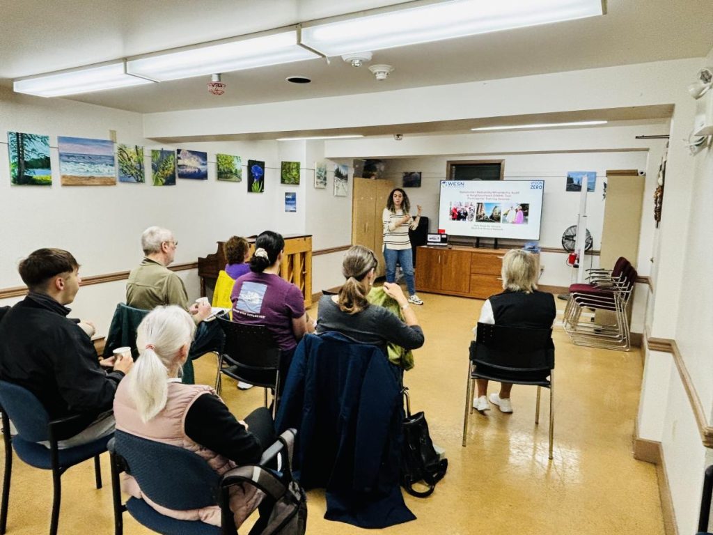
The Inclusive Environments Lab directed by Dr. Atiya Mahmood at SFU, has a research focus on examining housing, neighbourhoods, and the built environment through the perspectives of mobility, accessibility, and community participation, particularly for older adults and individuals with mobility, sensory, or cognitive disabilities. Currently, the lab is engaged in three core projects, two of which are a part of the MAP partnership: the Stakeholder Walkability/Wheelability Audit in Neighbourhoods (SWAN) and Project Sidewalk. By utilizing shared tools and sites, the lab aims to integrate knowledge mobilization activities and products across projects, enhancing outreach, promoting wider dissemination of findings, and ensuring the efficient use of resource.
Opening Poster shown in the Digital Gallery
One such knowledge mobilization output is the Digital Gallery by the Inclusive Environments Lab showcasing a collection of stories and insights from their community-based research projects. The gallery includes photovoice boards, short documentaries, and highlights from community forums that reflect lived experiences of participants in Metro Vancouver. Viewer can navigate the gallery via a guided tour or explore independently using the cursor. The gallery is a great resource for researchers, policymakers, students and community members to learn more about what’s being done to make communities more inclusive. Access the Gallery here.
Siding Wang (Sandy), Samna Sadaf Khan, Atiya Mahmood
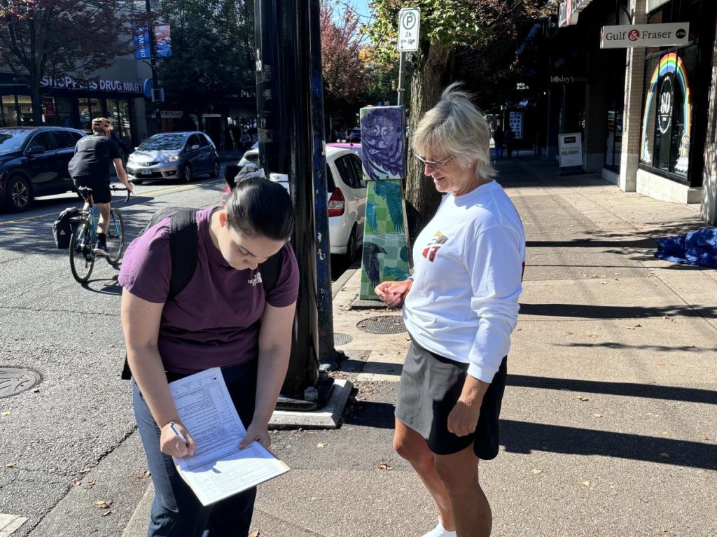
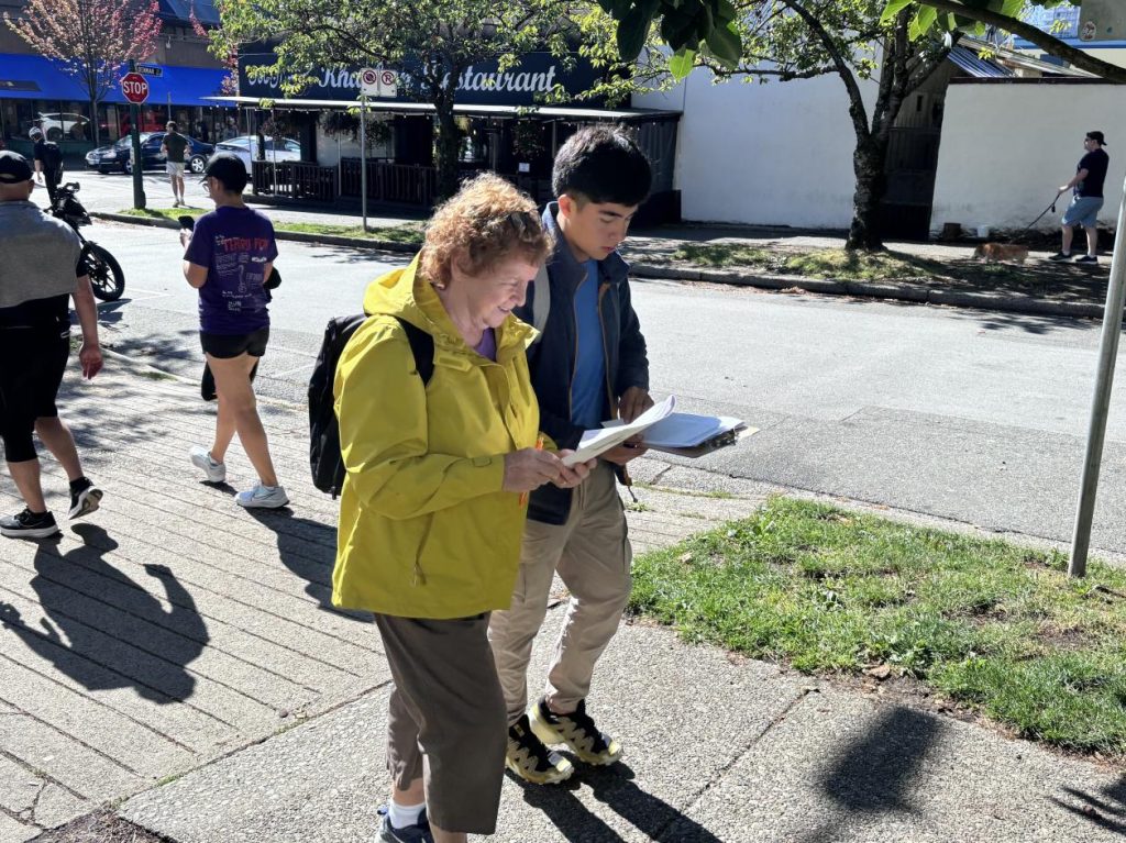
According to the 2020 West End Social Indicator Profile, 37% of West End residents experience limitations in daily activities, which is 6% higher than the city average. This limitation is particularly pronounced among older adults and seniors aged 65 and above, among whom the rate of activity limit is 60%. In terms of geographical location, the West End neighbourhood is located south of Stanley Park and east of English Bay, with a population density five times higher than the city average. The large tourist stream near the sightseeing sites, especially the prevalence of cycling near the park, complicates its traffic conditions. Such demographic and geographic characteristics suggest attention should be paid to the neighbourhood’s walkability for seniors. During my internship as a research assistant in the Department of Gerontology at Simon Fraser University, I participated in a community-based research project at West End Senior Network. Funded by Vision Zero, an organization aiming to improve road safety, this project assesses environmental challenges to seniors’ walkability in the West End neighbourhood and provide guidance for further local intervention.
The project employed a mixed-methods approach, combining quantitative and qualitative methodologies. Quantitative data was collected using ‘Stakeholders’ Walkability/Wheelability (SWAN)’ Audit in Neighborhoods to evaluate the walkability of seven key locations, while qualitative data came from two sources. The first source was an online pre-survey questionnaire, in which West End’s senior residents (n=82) were asked to describe issues in the areas they suggested for audit before the locations were chosen. The second source was a series of focus group discussions held immediately after each outdoor audit, where participants were asked to identify problems they observed during the audit as well as their past experiences in the neighborhood. Key locations to audit were identified based on responses to the pre-survey, which asked the open-ended question, “Where are some areas we should audit?” with four blanks for respondents to provide their answers. Respondents were then requested to “be specific by listing exact intersections or providing detailed descriptions of specific areas. Also, please indicate the issues you have in these areas”.
Although the research project originally focused on identifying road safety issues using a quantitative audit tool, qualitative data from the pre-survey and the first focus group discussion in which I participated provided an inspiring illustration of how elders in the West End neighborhood perceive, analyze, and may contribute to solving these problems—all rooted in their experiences as members of a constantly changing community. Studies have noted that older adults are often perceived as either individuals or members of an institution, whereas older adults themselves are more accurately seen as participants in a dynamic group process that is continually constructed and reconstructed (Bookman 2008). The qualitative data informed the following sections of my writing, where I will discuss the issues mentioned by the participants and share how their way of articulating these issues impressed me, shedding light on the design and implementation of an age-friendly community.
1. Physical Obstacles on the Sidewalk: “I Wish I Would Do it Myself”
The pre-survey reported some sections of the sidewalk to be narrow, uneven, cracked, or bumpy, with safety hazards exacerbated by certain weather conditions. Some places were described as “slippery in icy weather”, and some areas accumulated pools of water “too deep to walk through when it rains”. In addition to these surface problems, participants noted a lack of street amenities, frequently mentioning the need for benches, shelters at transit stops, and other seating options. Poor street lighting at night was also reported, diminishing participants’ sense of security. It is important to note that the lack of safe physical features affects not only the immediate experience of walking on certain roads, but also shapes residents’ walking behavior in terms of route selection, as a participant in the focus group discussion commented, “I think the biggest issue is the lighting, and so I try to avoid certain places”.
2. Ambiguity in Traffic: The Need for a Standardized Regulation Accessible to All
Aside from the physical features of the sidewalk, another set of factors hindering pedestrian safety is concerned with traffic. In the pre-survey, several participants reported “undifferentiated spaces” shared by both cyclists and pedestrians. More than 10 participants mentioned scooters and bicycles on the sidewalk. This situation is exacerbated for seniors with poor hearing, who “cannot hear the cyclists approaching”. While some are caused by people intentionally violating the rules, others are caused by ambiguity regarding the right of way. As explained by one respondent who reported themself as an urban planner, “What pedestrians do not know is that this route is part of a much wider bikeway route and having it on the map, creating the impression for the cyclists that they do really have the right of way.” Additionally, more than ten participants mentioned problems in detecting traffic situations, the most dangerous of which is the cars’ blocked vision. One respondent noted, “Drivers have trouble seeing pedestrians crossing from the park side due to the distraction of the middle lanes of cyclists”. Distractive noises, such as horns and sirens, were also mentioned as a concern.
Participants agreed that inconsistency in traffic design has contributed significantly to this problem. Not only is there inconsistency within the neighborhood, but inconsistency with other areas in terms of traffic regulation can also be an issue, especially when it comes to the West End. “I think what we are challenged within our community is that we have a lot of people that aren’t from here, and where they’re from, the traffic, the roundabout was managed in a different way… it would be nice if we could get some more support at that stage where driving a car is different experience”. The participant mentioned that the advanced green (a type of traffic light signal) is specific to British Columbia, which might confuse people from other places. Later in the discussion, another participant also noted the wayfinding problem “for strangers to the neighborhood”. As the West End becomes a multicultural neighborhood, it is encouraging to see that participants are genuinely concerned with the experiences of people who are new to the area. The participants are not just complaining about the obstacles they themselves faced but are genuinely considering people from different groups as stakeholders. I believe that this also sheds light on what equal accessibility means within a community.
3. Worries about Social Safety and Interaction: The Complex Dynamics of Community and Active Engagement
Most quantitative evaluative tools measure how the built environment supports a sense of community by the availability of public amenities and street furniture that fosters social interaction (Kan & Molinsky 2020). This, however, is not the only dimension where the social aspects of a neighborhood are embodied. The West End neighborhood had an overall high evaluation in terms of facilities, as commented by one participant in the focus group, “(West End is) probably one of the best places in the world in terms of peace and amenities”. Nevertheless, as the place changes over time, more problems regarding socializing in the neighborhood, including concerns on safety and interaction have arisen.
When discussing interactions with people that made them feel unsafe, one participant shared their experience of hearing hate speech and addressing the problem with a call to 911. This was followed by another participant, “What do you do if it doesn’t warrant a 911 call? Like, people are yelling and creating a feeling that it’s a bit hostile?” The situation of encountering unfriendly behavior in the community was experienced by another participant, who commented, “But we don’t have anything in our society that says, ‘Excuse me’, that’s not allowed in this way of living… that’s not how we work with each other”. This raised a critical point to the norms of interaction that shape the mezzo-level community, namely, how does community dynamics address circumstances that are insufficient to trigger police intervention but also beyond the control of individuals? The phenomenal approach to place emphasizes that people’s everyday experiences are integral to the place (Rowles 1983), and the impression of unfriendliness could negatively affect elderlies’ walking experience. “I think you always have to make a judgment when you’re coming up to somebody to whether you’re going to avoid or stop”. Everyday micro-interaction with pedestrians serve as an important source of social engagement, as studies on social interaction have shown that positive affective reaction could be elicited by brief exchanges such as eye contact (Hietanen 2018).
Also related to social engagement in a multicultural community is the language barrier. In explaining her experience of hearing languages she didn’t understand, one participant expressed that while “it’s neat to hear all the other languages” in the cosmopolitan community, she felt that when she tried to interact with people speaking different languages, “it’s almost like it’s a wall around them”. A second participant then recommended a translation application, which “is wonderful and does make that connection”. While some studies have shown that population turnover may increase older people’s sense of losing control over their environment (Buffel & Phillipson 2018), it is encouraging to see that participants are actively trying to connect with others in the neighborhood.
Rather than viewing the situation as static and simply identifying what is lacking, they aimed to uncover the complex origins of the problem. A typical case discussed was a former gathering place on a street corner, which had been “taken over by a group of people that lead different lifestyles” and was described by one participant as “very disconcerting”. Another participant explained that the city removed the area due to concerns over undesirable gatherings, “In dealing with the non-desirable grouping of people, (the city) removed some of the support sitting places for people who generally need them”. Recounting a friend who walked with canes and used to rest there, they commented, “who are suffering here are the people who could use the spaces”. This phenomenon was documented in the pre-survey as well, where a participant mentioned “people openly drinking, sprawling on benches which no one else can use”. This case suggests that some problems may not have simple solutions that can be resolved solely by adding physical resources, echoing recent criticisms on age-friendly design regarding an objected-focused, solution-driven approach where older people’s need is generically presumed (Handler 2018).
What is needed is an alternative approach where older adults are consulted and engaged in an age-friendly urban design. The multifaceted nature of safety is reflected in the problems regarding physical safety, traffic regulation and social integration in a changing neighbourhood. Beyond these challenges, we have also seen how the participants of Safe Steps for Seniors perceive problems in their neighbourhood from a relational, context-specific way. They view other stakeholders in the city, and which may inform further approach with a more agent-focused community building and management.
References
Bookman, A. (2008). Innovative models of aging in place: Transforming our communities for an aging population. Community, Work & Family, 11(4), 419-438.
Buffel, T., & Phillipson, C. (2018). A manifesto for the age-friendly movement: Developing a new urban agenda. Journal of aging & social policy, 30(2), 173-192.
Handler, S. (2018). “Alternative Age-Friendly Initiatives: Redefining Age-Friendly Design.” In Age-Friendly Cities and Communities: A Global Perspective (pp. 211-30), edited by T. Buffel, S. Handler, and C. Phillipson. Policy Press.
Hietanen, J. K. (2018). Affective eye contact: An integrative review. Frontiers in psychology, 9, 1587.
Kan, H. Y., Forsyth, A., & Molinsky, J. (2020). Measuring the built environment for aging in place: A review of neighborhood audit tools. Journal of Planning Literature, 35
Rowles, G. D. (1983). Place and personal identity in old age: Observations from Appalachia. Journal of environmental psychology, 3(4), 299-313.
Check out “Stepping Up: Enhancing Urban Mobility, Health, and Inclusion Through Sidewalk Investment in the City of Vancouver”, a research summary created in collaboration by the SFU Gerontology department, MAP SFU Team, City Studio and the City of Vancouver.
This summary was created for GERO 840: Developing Inclusive Urban Streetscape (Professor: Atiya Mahmood, Ph.D; prepared by: Esther Yunwono, Margaret Ovenell, Niloofar Hedayati, Rojan Nisiri, Sogol Haji Hosseini)
MAP team members recently published an article titled “Exploratory study on the adaptation of online services offered to people with disabilities, in the context of the COVID-19 pandemic” in the journal Disability and Rehabilitation: Adaptive Technology. The article explores the adaptation of healthcare services during the COVID pandemic from in-person to virtual, focusing on the implications for people with disabilities. Through their research, the team identified key facilitators and barriers that impacted the access to care for people with disabilities as well as potential areas of improvement that would support the ongoing accessibility of these community services. You can click on the links below to read the full article or learn more about the project!
The following infographics were prepared by the Active Transportation Policy Analysis project team. To learn more about this research project click HERE.
Infographic 1: The following document explains what public transportation is and some of the issues experienced by people with disabilities.
MAP project researchers in Québec have examined the reduction of services offered to people with disabilities during the COVID-19 pandemic, focusing on testimonials from individuals working in the field. Check out their series of infographics for more information.
Title:Providing community services for persons with disabilities during the COVID-19 pandemic: A scoping review
Objective: The aim of the study is to identify scientific literature that examines how community organisations and municipalities adapted services and resources provided to people with disabilities as a result of the COVID-19 pandemic. This will allow to an understanding of how organisations pivoted to accommodate challenges associated with the COVID- 19 pandemic and key strategies that can be utilised currently and in the future.
Method:A scoping review was conducted by searching different databasesin January 2021. A multidisciplinary research team (e.g., rehabilitation, gerontology, engineering) of seven co-authors (researchers, postdoctoral fellow, graduate, and undergraduate students, and two librarians), with experience conducting literature reviews collaborated on this review. To be included, studies needed to focus on community and public services provided to people with physical or cognitive disabilities and services adapted to the COVID-19 pandemic. The study selection was done by identifying the relevant studies from the literature, screening the studies by applying the criteria to the titles and abstracts, then examining the full paper and finally extracting the data. Two co-authors independently completed these steps, documented the reason for exclusion and then compared their results to limit human error. Disagreements between the two co-authors were either resolved by consensus or by another co-author.
Results:
Fifteen studies have been included from the initial search strategy of 7651 studies.
53% of the studies were conducted in the US.
Most services and resources (68%) involved some form of preventive healthcare (e.g., home care services) provided by some organizations (e.g., municipalities, governmental organizations, etc).
Most of these organizations (60%) delivered services to older adults, 20% delivered services to individual with intellectual disability, respectively 7% targeted all persons with disability, 7% targeted people with Parkinson’s Disease and 7% targeted individual who had experienced a stroke.
53% of the studies reported that virtual services were described as valuable and resulted in improved outcomes (e.g., social skills, quality of life, cognitive score).
However, this online transition process has required an increased workload from managers, as 13% of the studies reported.
As 7% of the studies highlighted, this negatively impacted the quality of communication between organizations and their members.
As a matter of fact, all studies reported some form of barriers when pivoting those services, such as technology difficulties
Concerns regarding access to technologies were reported. More isolated people or people living alone was also reported as a barrier to accessing services.
On another hand facilitators were also reported in 80% of the studies, such as some form of organisational facilitator (e.g., flexibility, planning).
Results highlight that the distribution and use of online services has increased since the COVID-19 pandemic.
Conclusion:The 15 papers published since the beginning of the Covid-19 pandemic, included in this scoping review, showed how community organizations and municipalities have pivoted to maintain their service offering to people with disability despite the social distancing measures.Online services delivery has increased during this period with valuable outcomes including the various barriers and facilitators that the organizations may have experienced.
What this paper adds to what is known about this topic:
Fifteen studies (between January 2021 and August 2021) presented the adaptations that community organisations or municipalities had to make to provide services and resources to people with disabilities during the COVID-19 pandemic.
Most studies concerned community organisations delivering resources and services for health prevention for older adults.
MAP-SWAN-SFU Reflection – Dementia Data Collection Author: Aislynn Sharrock
Introduction
This article describes my experience working as an undergraduate research assistant on the research project entitled “The Stakeholder’s Walkability/Wheelability Audit in Neighbourhoods (SWAN)”, led by Dr. Atiya Mahmood, at the Gerontology Department, Simon Fraser University. The SWAN project aims to empower people with various disabilities to advocate for inclusive communities and neighborhoods through using the SWAN tool. The SWAN tool facilitates participant-led evaluations of select streets and intersections by people with varying disabilities, including cognitive, mobility, hearing, and vision disabilities. The current version of the SWAN tool has been adapted for individuals with dementia or mild cognitive impairment (MCI) with the help of stakeholders (such as the Alzheimer Society of BC and Disability Foundation), advisory committee members, and people with lived experiences of dementia and MCI. Research data was collected with participants by completing a survey of the streets to explore barriers and facilitators to accessibility. This was followed by a brief interview to obtain information about the overall experiences of each participant.
Before starting recruitment for the dementia and MCI stream, we completed a pilot data collection session with a participant from the community to identify any potential issues that needed to be resolved. This participant agreed to have a follow-up interview with me (AS) to discuss their experience with our project, including working with the research assistants, as well as their opinions and reflections about anything that could be improved for future research projects involving participants with dementia and MCI. This participant had a previous relationship with the lead research assistant for the dementia group, Kishore Seetharaman, a graduate research assistant on the team with extensive experience working with people with cognitive disabilities. This facilitated the participant’s understanding of the research project. By conducting this follow-up interview, we hoped to uphold our commitment to a community-based participatory approach. This article includes reflections and feedback from our pilot participant as well as my personal reflections as an undergraduate research assistant, who was closely involved in data collections with the dementia population.
Personal Reflections
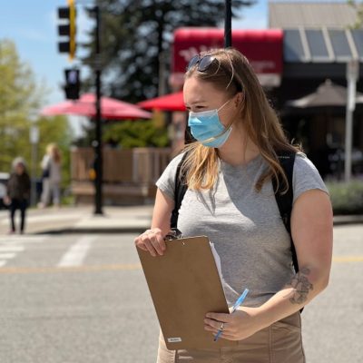
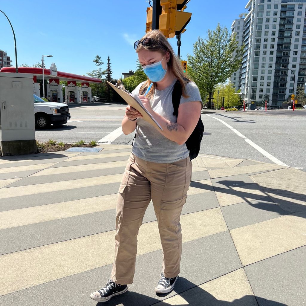
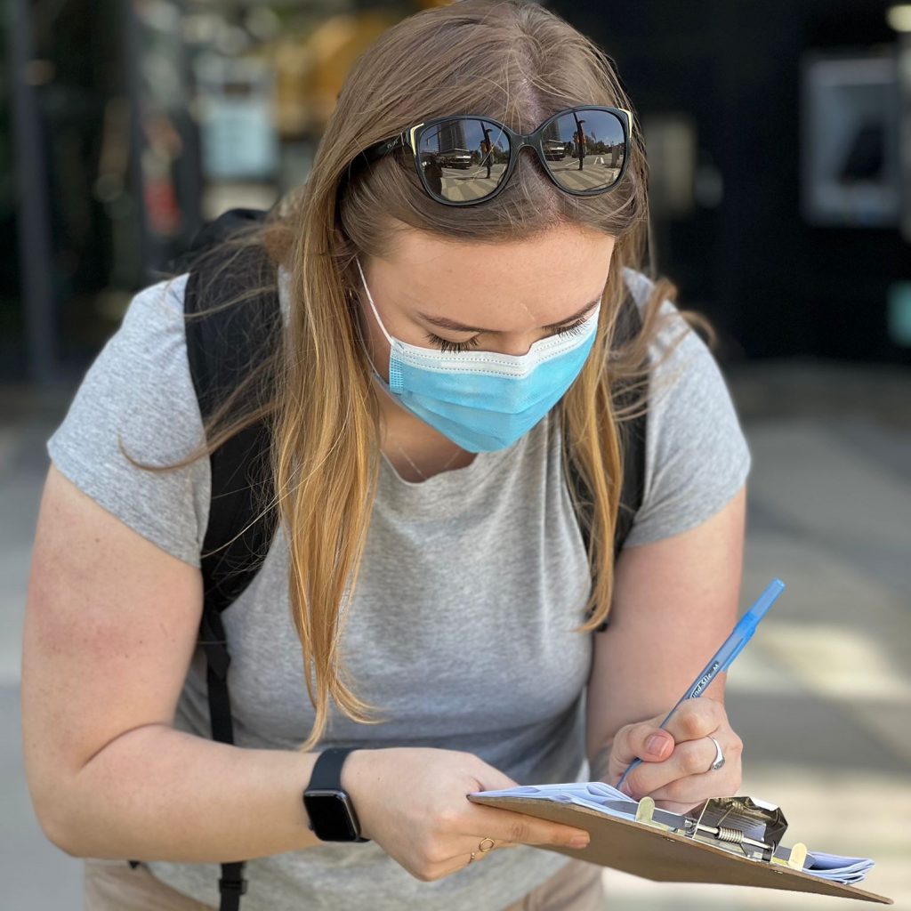
Aislynn Sharrock collecting data and writing on a clipaboard
It was my first time conducting data collection out in the field with dementia and MCI participants using the SWAN tool. I started out by taking photos of features in the built environment that were emphasized by the participant. In addition, I completed the SWAN tool through my perception of how the environment would impact people with dementia and MCI. This was completed as a way to validate the SWAN tool. All research assistants, including myself, were trained on how to work with people with various disabilities in different contexts and situations. Yet, I recognized that working with individuals with varying cognitive disabilities could require flexibility and exercising judgement on my part depending on their cognitive capabilities. My previous experience with seniors as a recreational worker at an Adult Day Program (ADP) made me realize how much I enjoyed spending time with them and listening to their stories and experiences.
Even though I was somewhat nervous to do data collection in the community, particularly in neighbourhoods that were unfamiliar to me, I was thrilled to gain experience in this unique context. Our team tried to implement specific arrangements to better accommodate participants with dementia and MCI as we wanted to make their experience as smooth as possible throughout the entire process. For instance, phone or email reminders prior to the day of data collection were often addressed to the participant’s primary caretaker, since participants often required a caretaker to support them with daily tasks. In addition, we attempted to simplify data collection with our participants by omitting questions that the research assistants could answer beforehand, such as answering questions that asked if certain features of the built environment were present or not. Additionally, there were subtle differences in the way questions would be worded to this subgroup of participants, such as refraining from starting a question with, “Do you remember…?”, and instead saying something like, “At the previous segment we walked, we encountered these issues with the crosswalk; do you notice those issues here as well?”
Furthermore, we modified our protocol for participants with dementia and MCI by asking them to choose the location for data collection. This was different that our previous method of selecting pre-determined intersections in a municipality the participant was familiar with. The other method involved picking busy intersections that stakeholders and people with lived experiences report need assessing because there are several issues with the built environment for people with varying disabilities. Upon reflection, it may have been useful to help the participants with dementia and MCI choose one intersection that had more accessibility issues to make better use of all the questions in the SWAN tool.
Moreover, in retrospect, I recall that many of our participants in this stream were accompanied by their primary caretakers, often their partners. While our data collection protocol emphasized that the answers should be directly provided by the participants to capture their point of view, we noticed that the participants would sometimes look to their caregivers for additional information. Some caregivers readily filled in when they noticed the participant unsure of an answer to a question, while others tried to probe the participant to recall the information themselves. It was evident that caregivers were familiar with the participants’ routines and were able to provide our research team with insightful answers, especially during the brief interview we conducted with the participant after walking the segments. In many cases, our participant’s caregivers were also their lifelong partners and therefore, were able to recount the participant’s experiences. Therefore, having only the participant answer seemed to not always be applicable for the dementia and MCI group.
Participant Reflection
Following the completion of data collection with the dementia and MCI participants, I was interested in the participant’s experience with data collection. Through this, I scheduled a one-on-one interview with one of our participants. The participant supported the change to our protocol that allowed participants with dementia and MCI to choose the neighbourhood for data collection rather than meeting at a pre-determined intersection that was less familiar to them:
“You have no history there so you can’t say ‘Well this is what I’ve experienced with this’ or… ‘You really have to watch out for this.’ Whereas, if you’re at a strange block [unfamiliar intersection] you’re so focused on where you’re walking and noticing a trip hazard, that you’re not necessarily seeing what else is around you to comment on.”
Our approach to site selection also meant that some of the intersections chosen by the participants were without traffic lights, amenities, or pedestrian signaled crosswalks, as those were often familiar residential streets close to their homes. Additionally, the participant was surprised that the length of the assessment was not longer, and they felt that it may not fully address the accessibility issues they encounter in their community. The participant shared that they would have preferred to walk further in their neighbourhood to capture more data. Reflecting on this, we could have given our dementia participants the added option of walking to other intersections in their neighbourhood that would be of interest so that they could highlight additional issues that they would like to communicate to us. The participant believed that much of the process of data collection was already decided upon before meeting with them. Based on their feedback, it sounds like we would have benefitted in giving our participants more of a choice and welcoming their initiative when it came to the number of intersections that we completed with them.
Conclusion
We finished data collection with ten participants with dementia or MCI and would like to thank our participants who provided us with invaluable insights on their experiences navigating their neighbourhoods and the built environment . We hope our work leads to making a positive change within municipalities around Greater Vancouver and beyond for people with disabilities.